https://syn-geo.com/wp-content/uploads/2017/10/water.jpg534740douglessohttp://syn-geo.com/wp-content/uploads/2016/09/Synergy-Logo-no-tag-340.pngdouglesso2018-03-02 18:23:212020-06-14 03:00:49Water sampling a thousand feet down
https://syn-geo.com/wp-content/uploads/2018/03/Salt-River-Corridor-60.mp4_000007083.jpg10801920douglessohttp://syn-geo.com/wp-content/uploads/2016/09/Synergy-Logo-no-tag-340.pngdouglesso2017-09-22 17:31:172020-06-14 03:02:34Corridor Mapping the Salt River
https://syn-geo.com/wp-content/uploads/2017/08/helitravel.jpg9001200douglessohttp://syn-geo.com/wp-content/uploads/2016/09/Synergy-Logo-no-tag-340.pngdouglesso2017-08-04 14:41:502017-08-04 15:30:53Progress Monitoring for Mining & Construction
https://syn-geo.com/wp-content/uploads/2017/02/GCP-image038-e1487058366814.jpg800600douglessohttp://syn-geo.com/wp-content/uploads/2016/09/Synergy-Logo-no-tag-340.pngdouglesso2017-02-14 08:16:072017-02-14 08:18:13Guidelines for Setting Ground Control Points
https://syn-geo.com/wp-content/uploads/2016/09/Los-Alamos-cliff.jpg20882550douglessohttp://syn-geo.com/wp-content/uploads/2016/09/Synergy-Logo-no-tag-340.pngdouglesso2016-10-11 21:19:342017-03-19 23:36:00Surveying in hard to reach places
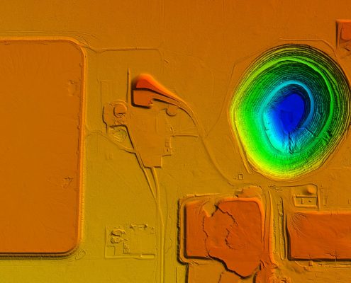 https://syn-geo.com/wp-content/uploads/2017/10/Sacaton-DTM.jpg
1254
2352
douglesso
http://syn-geo.com/wp-content/uploads/2016/09/Synergy-Logo-no-tag-340.png
douglesso2020-06-14 01:42:072020-06-14 02:59:04Surface Types
https://syn-geo.com/wp-content/uploads/2017/10/Sacaton-DTM.jpg
1254
2352
douglesso
http://syn-geo.com/wp-content/uploads/2016/09/Synergy-Logo-no-tag-340.png
douglesso2020-06-14 01:42:072020-06-14 02:59:04Surface Types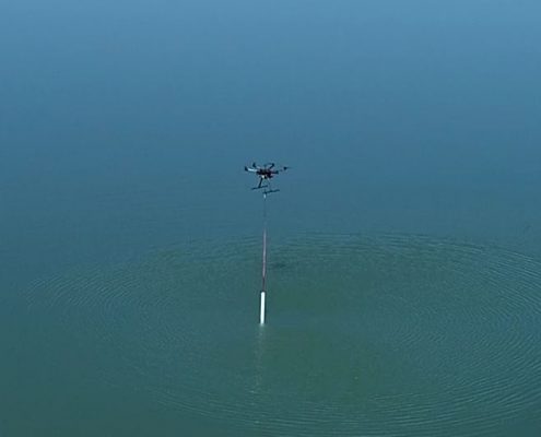 https://syn-geo.com/wp-content/uploads/2017/10/water.jpg
534
740
douglesso
http://syn-geo.com/wp-content/uploads/2016/09/Synergy-Logo-no-tag-340.png
douglesso2018-03-02 18:23:212020-06-14 03:00:49Water sampling a thousand feet down
https://syn-geo.com/wp-content/uploads/2017/10/water.jpg
534
740
douglesso
http://syn-geo.com/wp-content/uploads/2016/09/Synergy-Logo-no-tag-340.png
douglesso2018-03-02 18:23:212020-06-14 03:00:49Water sampling a thousand feet down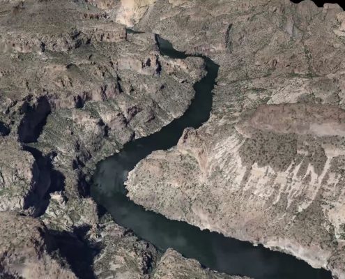 https://syn-geo.com/wp-content/uploads/2018/03/Salt-River-Corridor-60.mp4_000007083.jpg
1080
1920
douglesso
http://syn-geo.com/wp-content/uploads/2016/09/Synergy-Logo-no-tag-340.png
douglesso2017-09-22 17:31:172020-06-14 03:02:34Corridor Mapping the Salt River
https://syn-geo.com/wp-content/uploads/2018/03/Salt-River-Corridor-60.mp4_000007083.jpg
1080
1920
douglesso
http://syn-geo.com/wp-content/uploads/2016/09/Synergy-Logo-no-tag-340.png
douglesso2017-09-22 17:31:172020-06-14 03:02:34Corridor Mapping the Salt River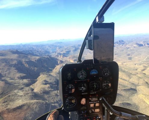 https://syn-geo.com/wp-content/uploads/2017/08/helitravel.jpg
900
1200
douglesso
http://syn-geo.com/wp-content/uploads/2016/09/Synergy-Logo-no-tag-340.png
douglesso2017-08-04 14:41:502017-08-04 15:30:53Progress Monitoring for Mining & Construction
https://syn-geo.com/wp-content/uploads/2017/08/helitravel.jpg
900
1200
douglesso
http://syn-geo.com/wp-content/uploads/2016/09/Synergy-Logo-no-tag-340.png
douglesso2017-08-04 14:41:502017-08-04 15:30:53Progress Monitoring for Mining & Construction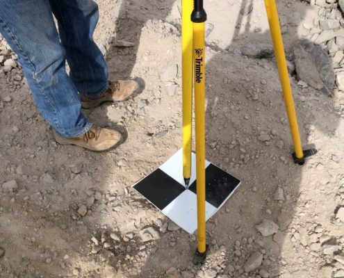 https://syn-geo.com/wp-content/uploads/2017/02/GCP-image038-e1487058366814.jpg
800
600
douglesso
http://syn-geo.com/wp-content/uploads/2016/09/Synergy-Logo-no-tag-340.png
douglesso2017-02-14 08:16:072017-02-14 08:18:13Guidelines for Setting Ground Control Points
https://syn-geo.com/wp-content/uploads/2017/02/GCP-image038-e1487058366814.jpg
800
600
douglesso
http://syn-geo.com/wp-content/uploads/2016/09/Synergy-Logo-no-tag-340.png
douglesso2017-02-14 08:16:072017-02-14 08:18:13Guidelines for Setting Ground Control Points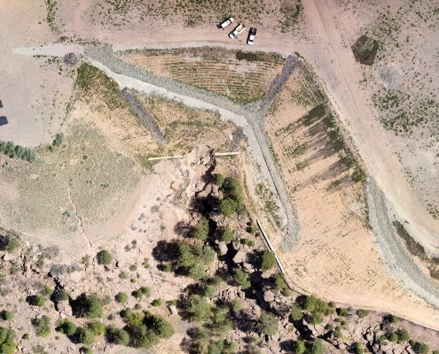 https://syn-geo.com/wp-content/uploads/2016/09/Los-Alamos-cliff.jpg
2088
2550
douglesso
http://syn-geo.com/wp-content/uploads/2016/09/Synergy-Logo-no-tag-340.png
douglesso2016-10-11 21:19:342017-03-19 23:36:00Surveying in hard to reach places
https://syn-geo.com/wp-content/uploads/2016/09/Los-Alamos-cliff.jpg
2088
2550
douglesso
http://syn-geo.com/wp-content/uploads/2016/09/Synergy-Logo-no-tag-340.png
douglesso2016-10-11 21:19:342017-03-19 23:36:00Surveying in hard to reach places