Synergy Geomatics LLC provides survey grade geospatial and inspection data to the engineering, mining, and construction industries – faster, safer, at higher quality and at lower costs than traditional aerial or land survey companies. Our formula for success blends experience with technology to collect, process and deliver data providing a remarkable value to our clients.
Who we are
We are a partnership of technical and operational experts in the field of geomatics -the collection, analysis, and interpretation of data relating to the earth’s surface. We bring together senior talent from surveying, geodesy, manned and unmanned aircraft based photogrammetry to solve problems. Our domain expertise, coupled with the latest technology delivers uncommon results for our clients. Our target industries include:
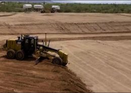
- Heavy civil
- Mining
- Pipeline
- Solar field
- Environmental engineering
- Disaster response mapping
- Landfill monitoring/modeling
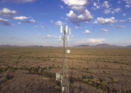
- Tower, Bridge & Structure inspection
What we do
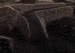
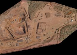
We specialize in the modeling of land surfaces, both natural and improved. Our collection rate, accuracy, and time to deliverable are unmatched in the industry. With a suite of cutting-edge tools across several domains of expertise, we can cut costs, while increasing quality and speed of delivery.
Our broad range of geomatics services includes:
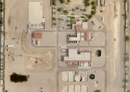
- High accuracy surface model development – TIN/DSM/DEM/Contour
- 5 to 50,000 acres
- Validated accuracy using the latest industry standards
- Precision Orthography: 1cm, 0.03′ – 15cm, 0.5′ Ground Sampling Distance (GSD)
- Machine control models and construction takeoffs
- Quarry mapping and inventory
- Wide area and long corridor mapping
- LiDAR – From interiors of buildings to massive topographic sites
- Architectural – Revit models, reliable as-built drawings
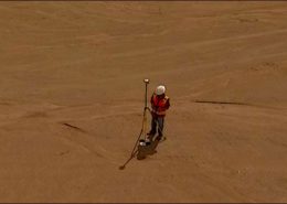
- Survey control, ALTA, topo, boundary