

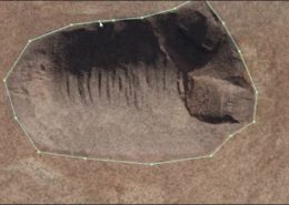
Stockpile Inventory & Reconciliation
Through accurate surface modeling, we are able to quickly compute stockpile volumes from a single scan, or calculate a volumetric analysis across scans. Coupled with your exported inventory data, we are able to measure the total quantity blasted, sorted, stored and delivered.


Data Processing
We provide the computing power and software know-how to go from the field to a finished surface
Marketing Data
Support your marketing and bidding teams with rich visual data

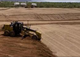
Progress Monitoring
Measure productivity quickly, safely, and without interruption

Survey Team Support
Boost your terrestrial survey production with cutting edge tools

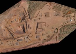
Earthwork Quantities
Higher precision quantities measurement, acquired in a fraction of the time

Terrain & Elevation Models
Richer data, collected faster, safer and at less expense than any other method.

 Latest sUAS News
- Regulator sets out vision for scaling drone operations across UK airspaceThe UK Civil Aviation Authority today published its Airspace Architecture Concept of Operations, setting out itsPress
- CONDUCT 2: Unifly Advances Conflict Detection and Airspace Segmentation for Urban Drone OperationsUnifly, a leading aviation technology company and provider of UAS Traffic Management (UTM) solutions, hasGary Mortimer
- Procore to Acquire DroneDeploy, Creating Next-Generation Platform That Sees, Understands, and Acts on the JobsiteThe proposed acquisition will bring DroneDeploy’s unified aerial and ground reality capture and robotics capabilitiesPress

