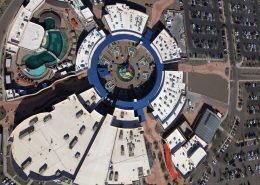

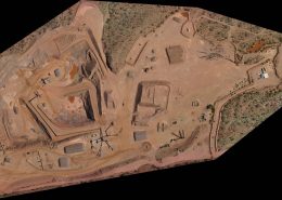
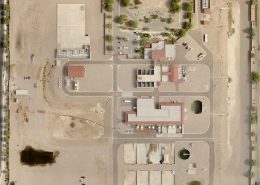
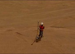
Mapping
Mapping using Structure from Motion (SfM) techniques & aerial nadir and oblique imagery produces rectified maps at a fraction of the cost of traditional aerial. With our drone platforms we can collect up to 2000 acres a day at 1″ GSD, and on the fixed wing platform up to 50,000 acres a day at 6″ GSD. Data can be delivered in all the standard formats to fit into your existing workflows.


 Latest sUAS News
- European defence companies sign Letter of Intent to establish the Bliksem EXO ConsortiumAirbus Defence and Space, Destinus, MBDA Deutschland, Safran Electronics & Defense, and Thales will developPress
- UAVOS Introduces NAVAI Vision-Based Navigation Module for GNSS-Degraded UAS OperationsUAVOS has successfully tested NAVAI, a vision-based navigation module for unmanned aircraft systems designed toPress
- Clearing the Path to BVLOS at Scale: High Lander and Thirdeye Bring Multi-Aircraft Detect-and-Avoid to the FieldAcross the world, lower-level airspace operates under visual flight rules, where many crewed aircraft flyPress

